What We Do

Surveying Services

From boundary definition to millimetre-accurate 3D capture — we have the technology and expertise to deliver on any project.

Boundary Surveys
Service

Boundary Surveys

Our licensed surveyors establish and mark legal boundaries with precision, providing the documentation required for property transactions, subdivisions, and resource consent applications. We work from current title records and historical survey data to deliver reliable, legally defensible results.

Equipment & Technology

GNSS receivers, total stations, digital levels

Typical Projects

Residential subdivisions, rural land transactions, boundary disputes, development consent applications

Turnaround

Typically 5–10 business days depending on complexity and title history

Request a Quote
Construction Setout
Service

Construction Setout

We translate engineering designs into precise physical positions on site, ensuring foundations, structures, and infrastructure are placed exactly where they need to be. Our setout services reduce costly rework and keep your project on programme.

Equipment & Technology

Robotic total stations, GNSS rovers, machine control systems

Typical Projects

Residential and commercial buildings, roading and infrastructure, retaining walls, utilities and services

Turnaround

Typically 1–3 business days for standard setout; ongoing support available for large projects

Request a Quote
Topographic Surveys
Service

Topographic Surveys

We capture the shape of the land — contours, features, structures, and services — to produce accurate topographic plans used by engineers, architects, and planners. Our deliverables are CAD and GIS-ready, formatted to your project requirements.

Equipment & Technology

GNSS receivers, total stations, drone photogrammetry

Typical Projects

Engineering design, resource consent, stormwater and drainage design, earthworks planning

Turnaround

Typically 3–7 business days depending on site size and complexity

Request a Quote
As-Built Surveys
Service

As-Built Surveys

We verify that completed works match the approved design, producing as-built plans for council compliance, code of compliance certificates, and infrastructure handover. Our records provide an accurate baseline for future maintenance and development.

Equipment & Technology

GNSS receivers, total stations, 3D laser scanners

Typical Projects

Residential and commercial builds, roading and drainage, utility networks, council infrastructure handover

Turnaround

Typically 3–5 business days after site inspection

Request a Quote
Drone Surveys
Service

Drone Surveys

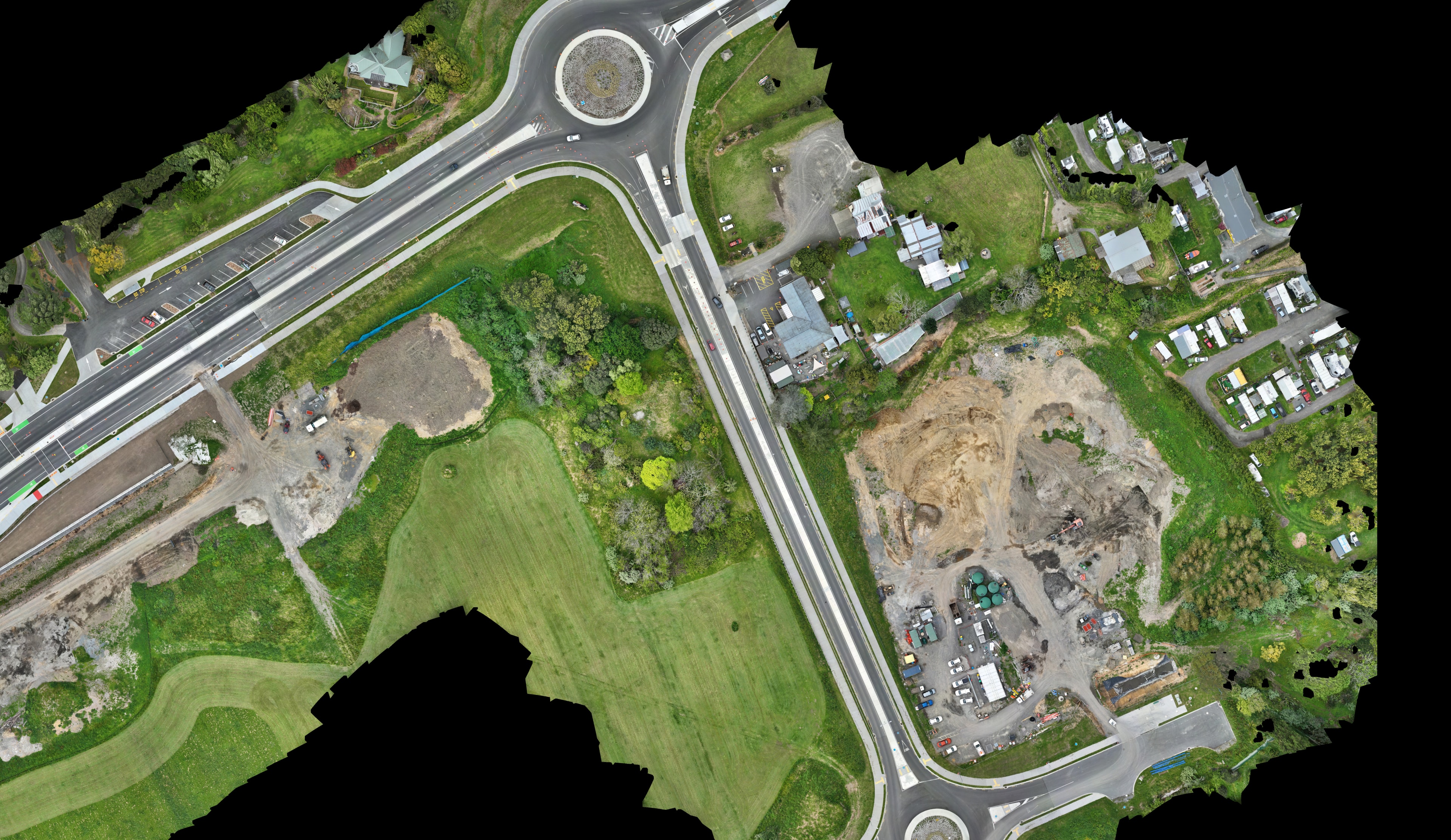
Our UAV survey capability delivers high-resolution orthophotos, digital elevation models, and volumetric calculations across large or complex sites in a fraction of the time of traditional methods. Ideal for earthworks monitoring, stockpile volumes, and site progress reporting.

Equipment & Technology

Survey-grade UAVs with RTK GNSS, photogrammetry processing software

Typical Projects

Earthworks and quarry volumes, large-scale topographic mapping, site progress monitoring, hard-to-access or hazardous terrain

Turnaround

Typically 2–5 business days from flight to final deliverables

Request a Quote
3D Laser Scanning
Service

3D Laser Scanning

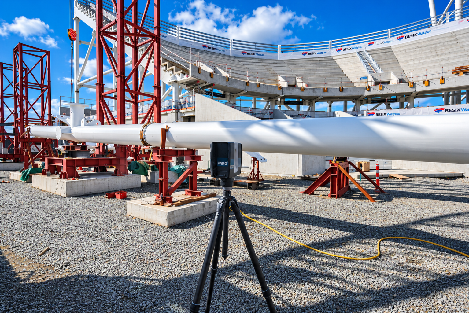
Our terrestrial laser scanning service captures millions of precise measurements per second, producing dense point clouds of structures, interiors, and infrastructure. Deliverables include registered point clouds, 3D models, and BIM-ready files — ideal for heritage recording, structural assessment, and renovation design.

Equipment & Technology

High-definition terrestrial laser scanners, point cloud registration and processing software

Typical Projects

Heritage and existing building documentation, structural assessment, BIM coordination, industrial plant and infrastructure, renovation and fitout design

Turnaround

Typically 5–10 business days from scan to processed deliverables

Request a Quote

Ready to discuss your project?

Get in touch for a no-obligation quote. We'll respond within one business day.

Pointworx Survey

Precision surveying services for construction, engineering, and land development across Philippines and New Zealand.

Copyright © 2026 Pointworx Survey — All Rights Reserved.